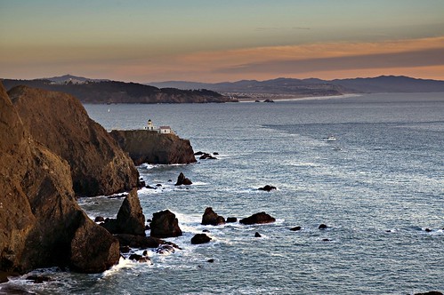
This photo shows another view of the Point Bonitas Lighthouse. The viewpoint is the same as the one from which I took this image of sunset in the clouds and this view of the Farallon Islands.
From this viewpoint, to the left and around the point is the Golden Gate and the channel under the Golden Gate Bridge.
Today the world of the Bay area is socked in with cloud, wind, and rain. Certainly, the Marin coast today would live up to its reputation as dangerous, shoal ridden, and fog-bound. So its good to remember that only a short time ago this fog-bound shore was, well, not fog bound.
Meta information: Nikon D70 Raw capture, AF-S VR-Zoom-Nikkor 70-200mm f/2.8G IF-ED at 70mm (appx 105mm 35mm equivalence); handheld using VR (vibration reduction).
Exif: ISO 200, 1/60 second, f/6.3.
Focus: Automatic, at infinity.
Post: The Raw file for the photo was processed twice (once for the ocean and once for sky and clouds) and combined using a layer mask and a gradient. Once the layers were combined, I performed routine level adjustments and sharpening.

Pingback: Photoblog 2.0: » Photoblog 2.0 Archive: » Trawling the Gulf of the Farallones